
I had a friend ask me this week for help planning his route to work using Metro. His motorcycle was in the shop, and he needed to get to Santa Monica from Downtown LA. I gave him my route of choice (720 all the way!), but suggested he check with Google Maps to see if a different route is recommended, and use the NextTrip feature on the Go Metro app for arrival times in realtime.
I pulled up this info myself on Google Maps to send him a screenshot, and I noticed something different. There was info included on the route options about some lines being delayed. Very helpful info!
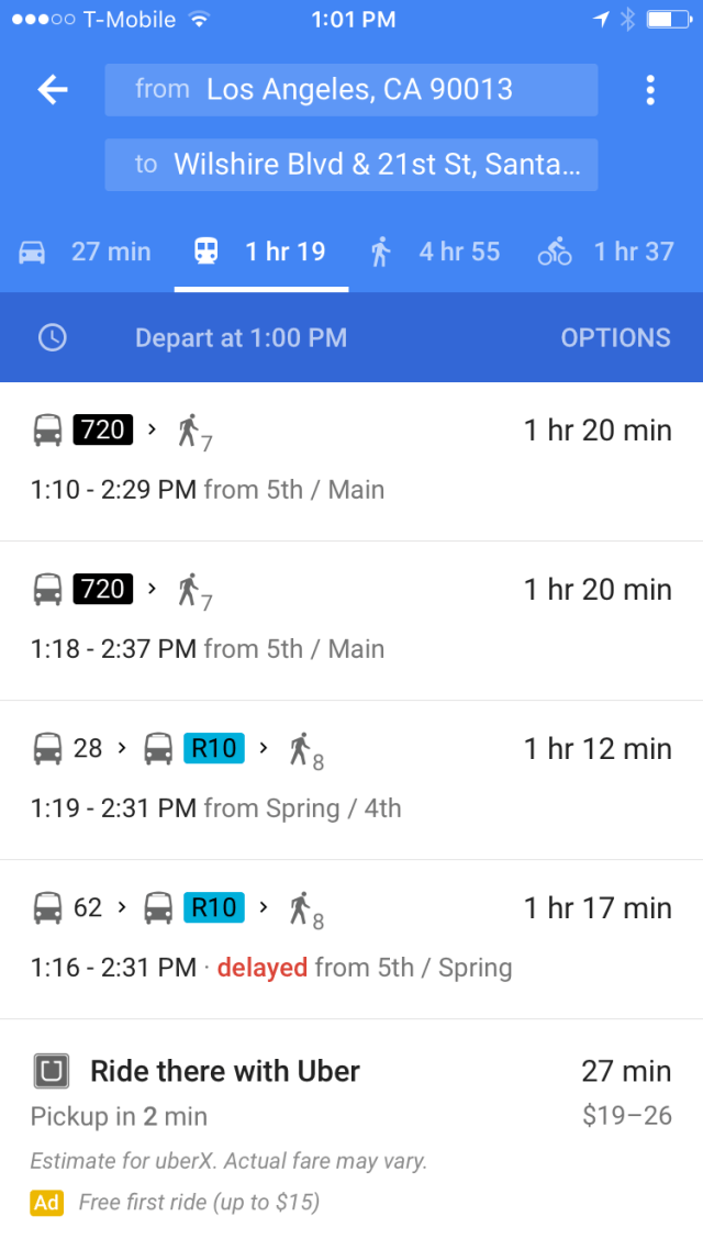
Great to know about any Metro delays through Google Maps!
According to Metro’s blog, The Source, it’s easy to get this info. Just open Google Maps and let it find your location. Tap on any of the transit icons and see which lines stop there. On-time arrivals are listed in green, where delayed arrivals are listed in red. Arrivals in black indicate no realtime data is available.
This new feature on Google Maps allows users to use one app only, and no longer requires users to go to the NextTrip app to check arrival times. Now, if only the Go Metro app had a more accurate trip planning feature. Then I could stick with that app instead of Google!
